A Two-Map Afternoon: Compare One Region at Two Scales
Compare maps at two scales to see how nearby towns, routes, and landforms connect—and make a clearer picture of what binds a region together.
How do you tell whether neighboring places really belong to the same region? A two-map afternoon gives you a useful way to look: compare a broad regional map with a closer view, and notice which connections appear at each scale. The broad map suggests the shape of the region; the detailed one shows how people and terrain link places on the ground.
Choose a region you can name without much hesitation: perhaps the valley around a familiar town, a group of coastal communities, or the uplands between two larger cities. Set aside a quiet afternoon, gather two maps that cover the same area at different scales, and keep a notebook nearby. The aim is not to draw a perfect boundary. It is to see how the region’s connections change as the map gives you more detail.
Choose a shared area
Start with a broad map that shows the region in relation to its surroundings. A state or provincial map, a road atlas page, or a regional map from a public mapping service can work. Then find a closer map that includes the same central area, such as a topographic map or a detailed street map.
Check that the maps overlap enough to compare the same towns and landmarks. If one map covers a coastline and the other stops inland, you may mistake missing coverage for a meaningful difference. Keep the central place or landmark in view on both maps; it will help you stay oriented as the scale changes.
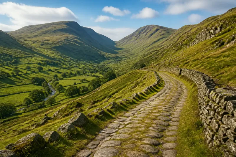
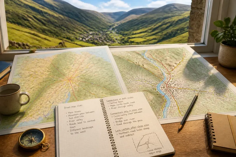
For a concrete choice, say you pick the cluster of towns around a low mountain pass. On the broad map, you can see the pass between two larger districts. On the close map, you may spot a road through the pass, a stream beside it, and settlements on either approach. Those details are clues to examine, not proof that every nearby place shares one identity.
Read the broad map first
Spend the opening part of the afternoon on the broad map alone. Mark the places that appear to organize the area: larger towns, prominent landforms, coastlines, major rivers, or routes that cross the region. Notice what sits just outside the area too. A nearby city or mountain range can shape how the region is understood, even if it is not usually counted as part of it.
Use a short notebook list rather than tracing a firm boundary. Record which places seem connected and what visible feature suggests the connection. A main road, a shared stretch of valley, or a line of settlements can each make the region appear coherent for a different reason.
- Which places are easiest to identify on this map?
- What landform or water feature gives the area a recognizable shape?
- Which routes appear to lead toward the same center or crossing?
- Where does the map seem to shift into a different landscape or settlement pattern?
Do not treat the map’s frame as a regional border. Mapmakers choose a page extent for convenience, and a county or district line may reflect administration rather than a shared landscape. At this stage, you are collecting visual clues, not deciding where the region must end.
Zoom in on connections
After a short break, turn to the closer map. Find the same center and follow the visible routes outward. Roads that looked like simple lines on the broad map may split, converge, or avoid steep ground; a river crossing may explain why settlements sit on one side rather than another.
Look for modest links as well as major ones. A local road joining two villages, a bridge connecting both banks, or a pass between neighboring valleys can matter more to everyday movement than a distant highway. Notice where the close map makes a connection clearer and where it complicates the broad map’s impression.
Imagine your chosen area has one large town and several smaller communities. The broad map makes them look like spokes around a hub, but the closer view shows a cross-valley road linking two villages directly. Add that link to your notes. The expected result is a more layered sketch: one central route and a second connection that the regional view concealed.
Pay attention to what the close map cannot tell you. A road’s presence does not reveal how often people use it, and a place name alone cannot establish how residents identify. Record what you can see, then leave questions about daily life open rather than filling them with assumptions.
Compare the two maps
Put the maps side by side and sort your notes into three groups: connections visible at both scales, connections that become clear only in the close view, and apparent links that look less certain after closer inspection. This simple comparison keeps the activity focused on scale rather than on finding a single correct outline.
Now sketch a loose region around the places you have been studying. Use a pencil and allow the edge to bend around visible features rather than forcing it into a neat shape. You might place a mountain ridge along one side, include towns connected by a pass, and leave out a neighboring settlement that faces toward another center. Keep the sketch provisional.
Write a short note beside the sketch explaining your choices. Name the roads, landforms, or crossings that connect the places, and identify one point where the broad and close maps offered different impressions. That explanation is more useful than a bold line alone because it shows what your regional idea rests on.
Two-map questions?
What map scales should I use?
Choose one map broad enough to show the region among its neighbors and another detailed enough to distinguish local roads, settlements, or terrain. The scale bar and map legend can help you judge whether each view is suited to that task.
Can I use digital maps?
Yes. Keep the same central place in view while changing the zoom level, and note which labels or features appear or disappear. A printed map can be easier to compare side by side, but either format can support the activity.
What should I do if the maps disagree?
First check whether their coverage, labels, or map purposes differ. Record the discrepancy rather than choosing a winner; one map may emphasize administrative lines while another gives more space to roads or terrain.
How do I know where the region ends?
For this activity, treat the edge as a question rather than a fixed answer. Note where routes, landforms, or settlement patterns seem to change, and remember that residents may describe regional belonging differently from a map.
Close the afternoon
Before putting the maps away, circle one connection you would want to check in person or ask a local resident about. It might be whether a pass feels like a shared gateway or a dividing point, or which town people visit for ordinary errands. You do not need to resolve the question that day; keeping it specific makes the map-reading honest.
It is not worth the effort to trace every lane, copy every place name, or force a tidy border around the page. A few clear connections are enough to reveal how a region can look different from far away and up close. Keep your notes with the maps, and the next time you compare regional maps at two scales, you will have a sharper sense of what to look for—and what the map cannot decide for you.